
The Langtang Trek has faced another devastating setback after the 2026 flood. However, the Langtang Trek is not affected, so learn what happened, whether trekking is currently possible, alternative routes for the Langtang Trek, and how future visitors can contribute to the region’s recovery.
Regd. No.: 26502/060/61
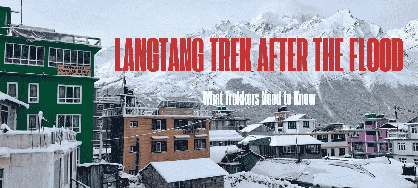
Langtang Trek After the Flood: What Trekkers Need to Know
The Langtang Trek to the Langtang region is one of the best treks in Nepal. The Langtang region is located to the north of Kathmandu, inside the Langtang National Park. Similarly, the region includes Langtang Valley, Gosaikunda Region, Panch Pokhari Region, and Helambu Region.
Langtang Valley has always been a place where the mountains feel very close. With the first Himalayan National Park of Nepal, Langtang National Park, the region also consists of glaciers, sacred lakes, Tamang villages, Buddhist monasteries, and Himalayan wildlife.
It is one of the most rewarding treks in Nepal, with quiet forests, villages, roaring rivers, and finally a valley that is surrounded by some of the Himalayas’ most impressive peaks. The peaks include Langtang Lirung, Langtang Ri, Salbachum, Yubra Himal, Naya Khanga/ Ghanja La Chuli, Yala Peak South, and many other peaks.
Major Attractions of Langtang
Langtang Lirung: It is the definition of the Langtang Valley and one of the major attractions and the heart of the Langtang Valley. Langtang Lirung Mountain, 7,234 meters, stands 23, 734 feet above sea level and makes your journey feel more interesting and memorable. It is also known as the signature mountain of the Langtang Valley.
Langtang Village: It is not only a stop along the trail but also a place where you can experience Tamang culture, traditional houses, mountain hospitality, and everyday Himalayan life. The village also carries a powerful story of resilience after the 2015 earthquake and its rebuilding.
Kyanjin Gompa: The upper end of the Langtang Valley has the Kyanjin Gompa, which is one of the biggest highlights of the Langtang Trek.
Kyanjin Ri: Standing at 4700 meters above sea level, it is the classic sunrise viewpoint above Kyanjin Gompa. This viewpoint is famous for majestic views of Langtang Lirung and the upper valley glaciers.
Tserko Ri: It is the highest non-technical viewpoint in the Langtang region at 4,985 meters above sea level. You will get a nearly 360° panoramic view up to Shishapangma on clear days.
Gosaikunda Lake: It is a sacred lake system revered by Hindus and Buddhists that lies in the Langtang region and is the source of the Trishuli River.
Langtang and Lirung Glacier: The Langtang Glacier is the longest glacier of the Langtang Region at 18km. This is why the Langtang is also named “Valley of Glaciers”
Langshisha Kharka: It is a remote alpine pasture located to the east of Kyanjin that is surrounded by hanging glaciers and peaks.
Rhododendron and Himalayan Forests: During your Langtang trek, the lower part of the trek takes you through beautiful forests filled with rhododendron, oak, pine, and other Himalayan vegetation.
Dorje Lakpa: Dorje Lakpa stands southeast of the Langtang Valley and is 6,966 meters high. It is another mountain that adds extra value to the Langtang skyline. It is also listed among the important peaks of the Langtang landscape.
Major Glaciers of Langtang
Have you heard about the “Valley of Glaciers”? If not, then it is Langtang. Langtang consists of many valleys and hanging glaciers. Some of the popular ones are:
- Langtang Glacier
- Lirung Glacier
- Yala Glacier
- Kimhsung (Kinjung) Glacier
- Langshisha and Shalbachum Glaciers
Popular Lakes and River Systems of Langtang
Langtang Khola (River): The Langtang Khola originated from glacial melt in the high basin above Kyanjin Gompa and is the main river flowing through the heart of the Langtang Valley. It flows to Langtang Village and Mundu, Ghoda Tabela, and Lama Hotel, and eventually flows downstream and feeds the Bhote Koshi River.
Trishuli River: What comes to mind after hearing Trishuli River? Rafting, right? Trishuli River is one of the most famous rafting rivers in Nepal. It comes from meltwater from Langtang Himal, Gosaikunda, and Bhotekoshi, and it mixes with the Marsyangdind and becomes the mighty Trishuli.
Bhotekoshi River: This river descends from the Bhot (Tibet), where Kyriong Tsangpi mixes with Lendi Khola, so it is named the Bhotekoshi River.
Gosaikunda Lake Complex: Gosaikunda, Bhairav Kunda, Saraswati Kunda, Surya Kunda, Ganesh Kunda, Nilkantha Kunda, Ama Kunda, Ragat Kunda, Naag Kunda, etc. Every year, in the month of August, during the Janai Purnima festival, thousands of pilgrims visit this sacred lake. It is believed that taking a holy bath in Gosaikunda cleanses sins.
Panch Pokhar (Five Lakes): It is a group of five lakes: Surya Kunda, Bhairav Kunda, Saraswati Kunda, Ganesh Kunda, Naag Kunda. Panch Pokhari is linked to different stories of Shiva and Parvati in local mythology.
Lirung Glacial Lake: The most interesting part of this lake is that it is Nepal’s first hydropower project built on a glacial lake. There is a small glacial lake above Kyanjin Gompa, Lirung Glacial Lake, that is feeding the Kyanjin Micro Hydro Project, a 100kW plant. It has contributed to supplying 24-hour electricity to Langtang Village, Mundu, Sindhum, and Kyanjin Gompa areas.
Parvati Kunda: Many of them miss it because it is a small hidden lake above Gatlang on the Tamang Heritage Trail. It is associated with fertility legends locally and can be reached in 45 minutes above the village.
What happened on August 26, 2026, in Nepal?
No one ever imagined seeing this destructive disaster! Nature has reminded us that it can be beautiful yet destructive and powerful.
On August 26, 2026, a massive flood disaster carrying rocks, mud, and debris occurred in the Bhote Koshi and Trishuli rivers, which began in the border area of Rasuwa, Timure. The reason behind this destruction is suspected to be the outburst of a glacial lake in Tibet. However, the actual cause of the disaster is still under investigation. The overflowing Bhote Koshi River swept away villages, roads, bridges, vehicles, and hydropower plants in the areas of Timure and Syabrubesi, including Nuwakot, Betrawati, Devighat, and Dhading, and further downstream in the Trishuli River.
The disaster was very dangerous and destructive; there was only a limited time to run away. There are a few preliminary scientific analyses regarding the disaster, and they are triggered by an ice avalanche that blocked the Lhende River of Nepal; the water rushed back downstream and merged with the Bhote Koshi River; and a glacial lake outburst. These preliminary analyses may be different because the final conclusion has not yet been reached, and authorities have launched an expedition for that.
The Department of Roads has mentioned that 32 strategic bridges in Rasuwa, Nuwakot, and Dhading have been completely washed away, 13 kilometers of the Pritivi Highway were covered with mud and debris, 87 telecom towers were affected, Rasuwagadhi customs and dry pots are completely destroyed, 220 kV substation is destroyed, and 111 MW Rasuwagadhi Hydropower Project, 78 MW Sanjen Khola, 60 MW Upper Trishuli 3A, 22 MW Chilime, 20 MW Langtang, 24 MW Trishuli, 14 MW Devighat and the Nepal Electricity Authority’s 25 MW solar project are the major operational projects that are affected. Additionally, several hydropower projects that were under construction were also significantly damaged.
Now, coming to human loss, as of August 30, 2026, according to the National Disaster Risk Reduction and Management Authority, the confirmed death toll is 734, and 2,498 are missing, including 589 foreign nationals; 933 people are linked to hydropower project sites, and 7,514 have been rescued till today.
Main Cause of the Devastating Flood
The whole nation is crying today and watching in grief because for a country so closely connected to its mountains and rivers, the disaster feels deeply personal. Everybody is wondering how something like this could happen so suddenly.
Researchers are still investigating to identify the exact cause of such a destructive flood. We will provide an update once the main cause is scientifically confirmed. However, there are different causes mentioned in different news, and here are some of them:
According to the National Disaster Risk Reduction Management Authority, a glacier collapsed in the mountain Langtang Lirung, and a temporary dam was created by rocks and debris that came down from the mountain, blocking the Lhende River. The dam burst out and resulted in a destructive flash flood.
According to Online Khabar, a Nepali news site, the massive flood was triggered by a possible glacial lake outburst or a landslide in the Tibetan region of China.
As per the Kathmandu Post, an earthquake and a glacier burst, followed by a huge avalanche, blocked the Lhende River. It formed a temporary dam. This temporary dam later burst, and it caused a devastating flood.
Is the Langtang Trek Still Possible After the Flood?
After the devastating flood of August 26, 2026, there is a big doubt about whether the Langtang Trek is still possible, and the short answer is that Langtang should not be written off simply because the Rasuwa flood damaged the usual access route. But everything is also not yet settled, and the usual way to the trail is badly disrupted. So, the important thing is to understand the difference between reaching Langtang and trekking inside Langtang Valley.
The flood caused enormous destruction along the Bhote Koshi corridor in Rasuwa, including the Syabrubesi area. The Langtang Valley trekking trail follows a different river system, the Langtang Khola. Hence, this geographical difference is important when understanding what has actually been affected.
Now, again, please do not misunderstand this because it does not mean the Langtang trail can automatically be considered safe or fully operational. TAAN has advised all trekkers and operators to plan accordingly to the latest access conditions. Additionally, a complete post-disaster assessment of individual trails, bridges, and crossings is still important.
Areas Affected by the August 26 Flood
Whole nations are crying today; a mother has lost her children, children have lost their parents, sisters have lost their brothers, families have lost everything they earned and saved. The flood affected much more than someone imagines. The worst-hit areas by the flood from the Lhende River are:
- Timure
- Syabrubesi
- Rasuwagadhi Rural Municipality
- Trishuli Bazaar and Devighat (Nuwakot)
- Dhading, Galchhi Area
What happened to the Normal Syabrubesi Route?
Syabrubesi is the most familiar gateway to Langtang, and traditionally, the Langtang Valley Trek begins with Kathmandu ->Dhunche ->Syabrubesi ->Lama Hotel -> Langtang Village -> Kyanjin Gompa.
Syabrubesi has been the gateway for years for trekkers going to the Langtang Region for treks like Langtang Valley treks, Gosaikunda treks, and Tamang Heritage Trail Trek; normally, trekkers drive from Kathmandu through Dhunche and continue toward Syabrubesi.
But the massive flood of August 26 has caused major damage around Syabrubesi and other settlements. Roads, bridges, and other infrastructure have been swept away and badly damaged.
So, if you think of the usual Langtang itinerary, it might not be possible. You can use the alternative route through Thulo Syabrubesi from dhunche. If you want to know detailed about route you can read our blog Alternative Routes to Langtang Trek After the Flood: Your Option
What about Langtang Valley itself?
People heard that Rasuwa was devastated by a flood, and they started imagining that the whole Langtang Valley trekking route has been swept away. This is only confusion.
Now, you might be thinking, are there alternative ways to reach Langtang?
Yes, there are, but some of them might still be affected and might be risky. So there is a route, but it is a bit different than the usual route and is the most effective for those who have already booked the Langtang Trekking, and the route is:
Sundarijal → Chisapani → Kutumsang →Thadepati → Phedi → Gosaikunda Lake → Thulo Syabru → Pairo → Bamboo → Rimche → Ghoda Tabela → Langtang Village
So, Is Langtang Trek Still Possible?
Yes, but not in the same way as it was before the flood. And yes, the devastating flood has made the traditional access through the Rasuwa corridor much more complicated, particularly around Syabrubesi. But it would be misleading to say the entire Langtang Valley Trek has simply disappeared or been destroyed.
Safety Reminders For Residents and Visitors
- Stop relying on an old itinerary and strictly avoid travelling to Syabrubesi.
- If you are in Kathmandu already and planning to move towards the trek, then check the latest road and trail conditions before leaving.
- Do proper research on whether the condition of bridges, roads, and water crossings of the alternative routes are all okay or not. You can contact and get help from a trusted trekking agency like Adventure Glacier Treks.
- Make sure to travel with a knowledgeable local guide. Do not plan or start the Langtang Trek independently.
- Follow the instructions from local authorities and trekking organizations.
- Do not enter an unsafe or restricted area just because you have already booked your trek.
- If you have already booked, then do not cancel immediately; hold and monitor the situation.
Langtang Still Welcomes You!
If you think Langtang is only a trekking route, then you are wrong because it is more than a trekking route. It is a valley of villages and families, guides, porters, lodge owners, farmers, and communities whose lives have long been connected with the mountains.
The recent disaster in Nepal has brought an enormous challenge to the wider region, and it may take some time for recovery, but such disasters do not have to be the end of a destination’s story. Hence, Langtang still welcomes you!
This time, your trek to Langtang will not be limited to ticking another Himalayan trek off your bucket list; instead, each of your efforts will be counted. Your stay in a local lodge, meal at a tea house, use of local guides and porters, and purchases from local businesses can help tourism continue in the region, as the locals' whole life and economic stability are dedicated to and depend on tourism. Therefore, your journey will become a small but meaningful contribution to the region. But this does not mean rushing; the recovery is still underway. As a responsible visitor, your first responsibility is to respect safety instructions and give communities the time they need.
If you are also looking to contribute from your country Nepal Goverment is seeking help from all over the world, which you can donate through this link: Nepal Prime Minister’s Disaster Relief Fund
Final Thoughts
Overall, the Rasuwa flood has changed the way we look at the journey to Langtang, but it is not what you think, and it is not the end of the journey. Some familiar and traditional routes are badly affected. However, there are other alternative approaches and other nearby trekking routes that will still give you a way to experience the beauty of the Himalayas.
Langtang still welcomes you and awaits you. So, if you have been dreaming of Langtang, you don’t need to give up. Yes, I agree the route might be changed; the journey might look different, but the mountains, culture, and warm spirit of Langtang remain.
Frequently Asked Questions (Last Updated: August 30, 2026)
Is the Langtang Valley Trek difficult?
Langtang Valley Trek is considered a moderate trek. However, it is described as an easy or difficult trek by people, depending on their fitness level, weather, trail conditions, and other factors.
What is the biggest glacier in Nepal?
The Ngozumpa Glacier, below the mountain Cho Oyu, is the biggest and the longest glacier in Nepal. This glacier stretches for around 36km and is also one of the largest glaciers in the Himalayas.
Where was the glacier that collapsed in Nepal?
Although there are no exact facts and conclusions on this, it is suspected that the glacier near Langtang Lirung in the Rasuwa region collapsed in Nepal on August 26, 2026, triggering the devastating flood.
Is the Langtang Trek open after the Rasuwa flood?
Langtang is not affected by the flood; only the gateway to the Langtang trek is affected. So, the Langtang Trek is open, but only via the alternative routes; the usual route to the Langtang Trek is damaged. But at present, you should not travel to Langtang without checking the latest local safety information.
Is Langtang Trek safe after the Rasuwa flood?
The destructive flood has damaged roads, bridges, and several villages, including Nuwakot, Mailung, and Syabrubesi, etc., and there might still be risks of landslides and changing river conditions. So, safety will depend on the particular route and its condition at the time of your travel.
What happened to the Langtang Trek after the Rasuwa flood?
The flood swiped away the main Langtang trekking route, and nearby areas are also severely disrupted. Several roads, bridges, and settlements along the Rasuwa corridor are badly affected, and the traditional journey toward Syabrubesi is difficult. However, the actual condition of individual trekking sections needs to be assessed separately rather than assuming that the entire Langtang Valley trail has been destroyed.
What is the alternative route to Langtang after the Rasuwa flood?
Here is one of the best alternative routes to Langtang after the Rasuwa flood.
Sundarijal → Chisapani → Kutumsang →Thadepati → Phedi → Gosaikunda Lake → Thulo Syabru → Pairo → Bamboo → Rimche → Ghoda Tabela → Langtang Village
Can you reach Langtang without going through Syabrubesi?
Yes, you can reach Langtang without going through Syabrubesi. As mentioned above, there is a different route via Sundarijal and Kathmandu; you can reach Langtang.
Can you reach Langtang from Dhunche after the flood?
Currently, Dhunche is considered an alternative access point to the Langtang region; however, this is not a guaranteed open route because the road conditions to reach Dhunche are also affected.
Need Help? Call Us+977 9851084187orChat with us on WhatsApp
Latest Travel Blogs
Sep 28, 2026
Chitwan National Park Tour: Wildlife, Culture, and Family Adventure
If you think Nepal is only about mountains and trekking, then Chitwan National Park offers a completely different side of [...]
Sep 16, 2026
Things To Do in Nepal Besides Trekking: More Than Mountains to Explore
Nepal is more than trekking. There are cultural cities, wildlife safaris, village life, local food, educational tours, adventure, relaxation, and [...]
Need Help? Call Us+977 9851084187